News

New release: version 12 of Maritime Boundaries
Added on: 2023-10-26 11:37:16 by Whatley, Lawrence
MarineRegions.org is proud to launch version 12 of the Maritime Boundaries Geodatabase. ...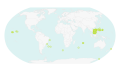
Marine Regions completes annual integration of GEBCO and ACUF gazetteers
Added on: 2023-07-28 16:33:30 by Lonneville, Britt
161 new GEBCO features added and seamless matching of ACUF features in Marine Regions gazetteer ...Marine Regions endorsed as a Project Action under the Ocean Decade
Added on: 2023-06-22 11:17:31 by Lonneville, Britt
Marine Regions received endorsement by the Ocean Decade as a Project Action, entitled “From global gazetteer to global community”. ...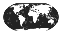
Update of two datasets: SeaVoX Salt and Fresh Water Body Gazetteer (v19) and UNESCO World Heritage Marine Sites (v02)
Added on: 2023-02-08 16:44:46 by Lonneville, Britt
New high-value datasets are available for download and have been updated accordingly in the gazetteer ...Geo stack updated to latest stable versions
Added on: 2022-12-20 09:48:29 by Vanhoorne, Bart
The Geo stack of marineregions.org has been upgraded to the different latest versions. ...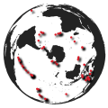
Yearly integration of new GEBCO and ACUF features completed
Added on: 2022-11-29 12:04:46 by Lonneville, Britt
Marine Regions has finished its annual integration of new features from the GEBCO and ACUF gazetteers ...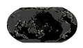
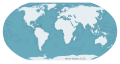
New data product: Extended Continental Shelves
Added on: 2022-10-13 15:23:00 by Lonneville, Britt
MarineRegions.org is proud to launch the first version of the Extended Continental Shelves dataset ...
How do you use marine data hosted in Flanders?
Added on: 2022-09-24 07:24:03 by Vanhoorne, Bart
Flanders manages a large amount of marine data. To get an idea of the use and social value of this data, EWI (Science, Technology and Innovation in Flanders) launches a survey in cooperation with OECD. ...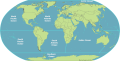
Global Oceans and Seas latest addition to Marine Regions data products
Added on: 2021-12-21 10:11:57 by Lonneville, Britt
Marine Regions now provides a brand new dataset focused on the 10 main oceans and seas ...
MarineRegions Exclusive Economic Zones now featured as essential map on MarineTraffic.com
Added on: 2021-05-04 13:51:22 by Tavernier, Annelies
An important dataset from MarineRegions (LifeWatch Belgium) is integrated in MarineTraffic.com and helps to improve the experience of millions of users on a monthly basis. ...
Flanders supported research data infrastructures played key role in UN Ocean report
Added on: 2021-04-27 14:17:18 by Vandepitte, Leen
On 21 April 2021, the United Nations launched the Second World Ocean Assessment (WOA 2) on the state of the world’s ocean, covering environmental, economic and social aspects. ...LifeWatch Flanders ready for the next level!
Added on: 2021-02-09 11:05:14 by Dekeyzer, Stefanie
The Flemish LifeWatch Consortium receives additional funding for the next years. ...Yearly integration of new GEBCO, ACUF and New Zealand features completed
Added on: 2020-09-28 16:00:36 by Lonneville, Britt
Marine Regions has finished its annual integration of new features from the GEBCO, ACUF and New Zealand gazetteers. ...The High Seas. A new member of the Maritime Boundaries family.
Added on: 2020-08-27 12:58:29 by Fernandez, Salvador
MarineRegions.org releases the first version of the High Seas, the last addition to the Maritime Boundaries dataset. ...Marine Collaborative Australian Protected Area Database (CAPAD) available in gazetteer
Added on: 2020-05-05 16:43:22 by Lonneville, Britt
Marine Regions added over 350 protected areas in Australia's state and Commonwealth waters to its database. ...Updates of Maritime Boundaries derived products: The Intersection with IHO Areas and The Union with the World Countries
Added on: 2020-03-24 10:11:35 by Fernandez, Salvador
MarineRegions.org launches the version 4 of the intersect of the Exclusive Economic Zones (EEZ) and IHO sea areas & the version 3 of the union of world country boundaries and EEZ's ...New release: version 11 of Maritime Boundaries
Added on: 2019-11-19 16:23:30 by Lonneville, Britt
MarineRegions.org is proud to launch version 11 of the Maritime Boundaries Geodatabase. ...HAB monitoring grids added to Marine Regions
Added on: 2019-07-24 12:12:21 by Lonneville, Britt
Monitoring grids for Harmful Algal Blooms available in Marine Regions gazetteer ...Integration of new GEBCO, ACUF and New Zealand features
Added on: 2019-05-29 15:11:49 by Lonneville, Britt
Marine Regions has completed its yearly integration of new features from the GEBCO, ACUF and New Zealand gazetteers. ...New release of global contourite distribution database
Added on: 2019-03-20 15:28:37 by Schepers, Lennert
Last summmer 211 new drifts were added to our global contourite distribution database. We now have 380 drifts as (multi)polygon, 28 drifts as point and 20 contourite depositional systems (CDS) available as download. We just published them officially with doi: https://doi.org/10.14284/346! ...[Add]

