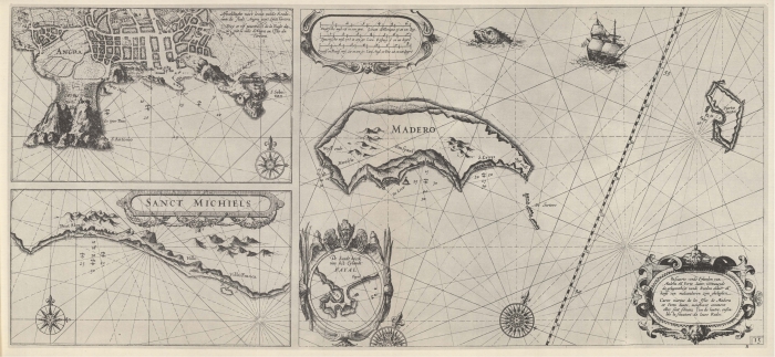
Blaeu (1612, kaart 17)
Description Pascaarte vande Eijlanden van Madera en Porto Santo, vertoonende de gelegentheyt vande Reeden aldaer en hoese van malcanderen zijn gheleghen = Carte marine de les Isles de Madere et Porto Santo, monstrant comment elles sont situeez l'un de lautre, ensemble la situation de leurs Rades
Datum: 1612
Plaats: Madeira
JPG file - 3.88 MB - 6 638 x 3 073 pixels
added on 2011-08-111 653 viewsMarine Gazetteer Places on this image:Madeira
From reference Skelton, R.A.; Blaeu, W.J. (1964). The Light of Navigatio... (page [169])
This work is licensed under a Creative Commons Attribution-NonCommercial-ShareAlike 4.0 International License