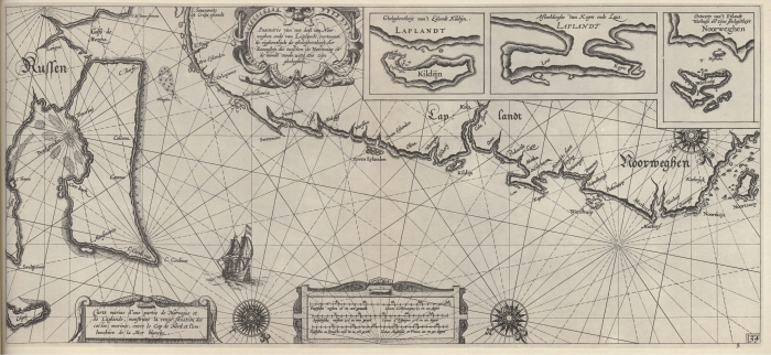
Blaeu (1612, kaart 36)
Description Pascaarte van een deel van Noorweghen ende van laplandt, vertoonende eijghentlijck de gheleghentheijt der Zeecusten die tusschen de Noortcaap en de mondt vande witte zee zijn gheleghen = Carte marine d'une partie de Norvegue et de Laplande, monstrant la vraije situation des costes marines, entre le Cap de Nord et l'embouchure de la Mer blanche
Datum: 1612
Plaats: Noord-Europees Rusland
JPG file - 3.88 MB - 6 630 x 3 059 pixels
added on 2011-08-121 444 viewsMarine Gazetteer Places on this image:Northern European Russia
From reference Skelton, R.A.; Blaeu, W.J. (1964). The Light of Navigatio... (page [310])
This work is licensed under a Creative Commons Attribution-NonCommercial-ShareAlike 4.0 International License