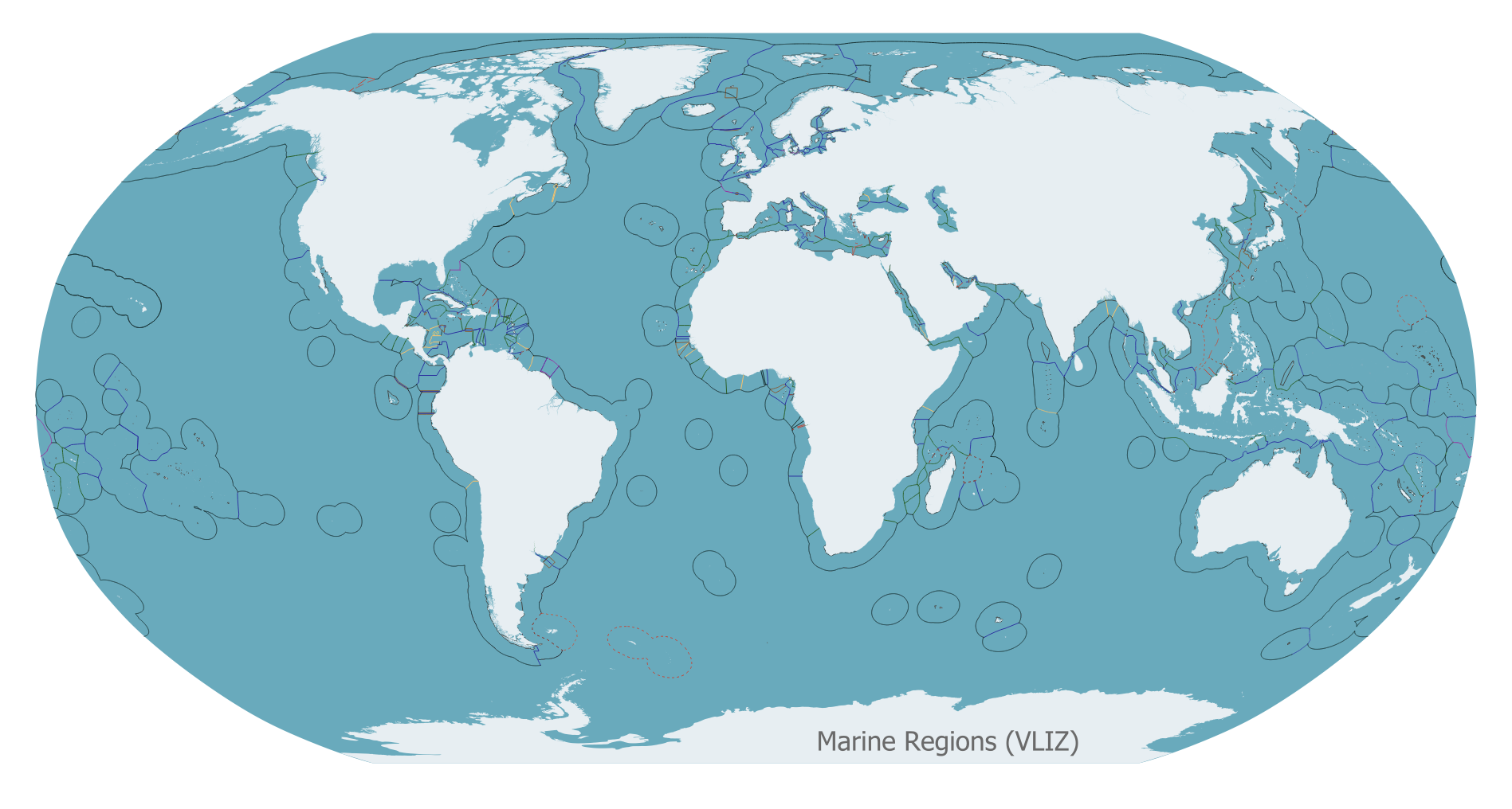
EEZ boundaries
Maritime Boundaries are important for many applications. In biogeography for example, a layer of EEZ-polygons could be used for the creation of species distribution lists per country.
Up to now, there is no global public domain cover available. Therefore, the Flanders Marine Institute decided to develop its own database. The database includes two global GIS layers: one contains polylines that represent the maritime boundaries of the world countries, the other one is a polygon layer representing the Exclusive Economic Zone of countries. The database also contains digital information about treaties.
As the information on which the database is based is in most cases freely available over the internet, we are not planning to charge any money for the distribution of the data and are considering the database as an Open-Source project. Since Maritime Boundaries are a relatively new concept, there are still many countries that have not reached an agreement with their neighbours about their maritime boundaries; new treaties will be negotiated in the coming years. Therefore, we hope that users will contribute to this database and keep us up to date with new developments of their country's boundary or other countries that they are aware of.