| MRGID |
http://marineregions.org/mrgid/10192 |
| Status |
Proposed standard  |
| Names |
| Language |
Name |
Name source |
| English | Cuverville Island | SCAR Composite Gazetteer |
| French | Ile Cavelier de Cuverville | SCAR Composite Gazetteer |
| Spanish | Cuverville, Isla | SCAR Composite Gazetteer |
| Dutch | Cavelier de Cuverville eiland | Federaal wetenschapsbeleid (2008). Four maps representing Belgian toponyms in Antarctica. [S.n.]: [s.l.]. (look up in IMIS) |
|
| PlaceType |
Island |
|
|
| Latitude |
64° 41' 0" S (-64.6833333°) |
| Longitude |
62° 38' 0" W (-62.6333333°) |
|
|
| Source |
SCAR Composite Gazetteer, available online at https://data.aad.gov.au/aadc/gaz/scar/ |
|
|
| Images |
|
| Notes |
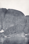
Belgica information (en): Dark, rocky island lying in Errera Channel between Arctowski Peninsula and the N part of Ronge Island, off the W coast of Graham Land. Discovered by the BelgAE under Gerlache, 1897-99, who named it for J.M.A. Cavelier de Cuverville (1834-1912), a vice admiral of the French Navy (http://www.mapplanet.com/?do=loc&country=_A&adm1=08&loc=20002788 / http://geonames.usgs.gov). |
|
Belgica information (en): Dark, rocky island lying in Errera Channel between Arctowski Peninsula and the northern part of Rongé Island, off the west coast of Graham Land. Discovered by the Belgian Antarctic Expedition under Adrien de Gerlache, 1897-1899, who named it for J.M.A. Cavelier de Cuverville (1834-1912), a vice admiral of the French Navy and superior officer of G. Lecointe during his training in the French Navy. |
|
Belgica information (fr): Ile noire et rocailleuse située dans le chenal Errera entre la péninsule Arctowski et la partie nord de l’île Rongé, au large de la côte ouest de la Terre de Graham. Découverte par l’expédition belge en Antarctique de 1897-1899 sous le commandement d’Adrien de Gerlache et baptisée par lui en l’honneur de J.M.A. Cavelier de Cuverville (1834-1912), vice-amiral de la Marine française et supérieur de G. Lecointe pendant sa formation dans la Marine française. |
|
Belgica information (nl): Dit donkere, rotsachtige eiland ligt in het Errera Kanaal tussen het Arctowski Schiereiland en het noordelijke deel van Rongé Eiland, voor de westkust van Graham Land. De Belgische Antarctica expeditie (1897-1899) onder leiding van Adrien de Gerlache ontdekte het eiland en noemde het naar J.M.A. Cavelier de Cuverville (1834-1912), viceadmiraal van de Franse marine. Hij was de officier van G. Lecointe tijdens zijn opleiding bij de Franse marine. |
|
|
| Relation |
|
| Map |
|
|
|
|
|
|
|
| Edit history |
Last edited on 2006-04-06 14:59:04 by Deckers Pieter
|
|
|
|
|
|
[Google] [Google scholar] [Google images] |


