Tutorial
Introduction
You have access to add and edit the information in the system. Before you change existing information, it is important that you do not overwrite valuable information or add information that is already in the system. Since every GeoObject has a unique identifier, having the same feature twice in the gazetteer could create confusion and goes against the goal of the gazetteer. Synonyms of a GeoObject or a name in another language should be added to the existing GeoObject instead of creating a new one.
Below you will find an explanation on how to add information to the MarineRegions gazetteer. If you have any questions, please do not hesitate to contact us at info@marineregions.org.
Instructions
Online editing

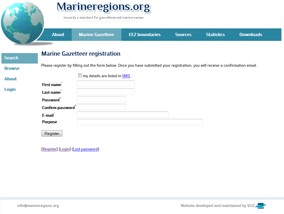
 How to register?
Please register on the Marine Gazetteer registration page. WoRMS editors can use their WoRMS credentials to log in, and can proceed to the next step immediately.
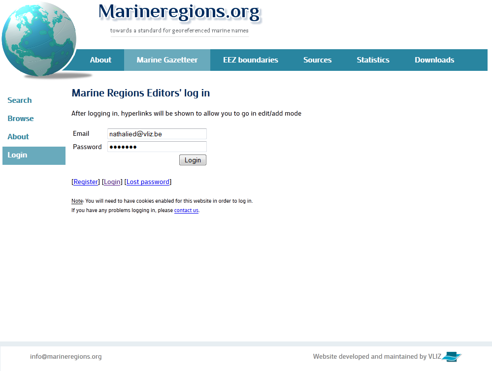
How to log in?
Use your user name (email) and password to login to Marine Regions.
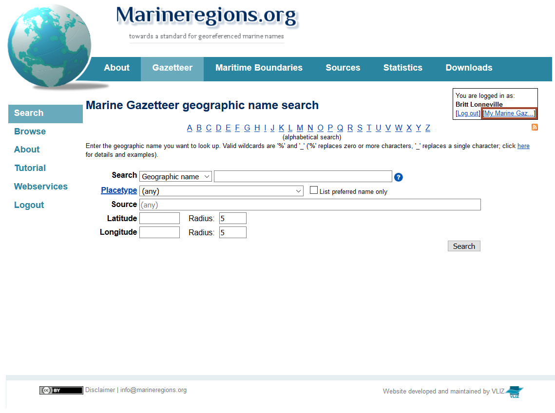
My Marine Gazetteer
Once logged in, you can access 'My Marine Gazetteer'.
In this section you will see the different modules you can access as an editor:
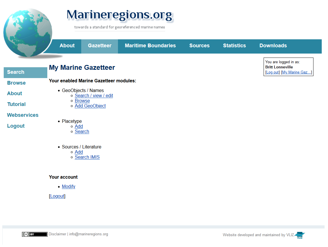
- Your enabled Marine Gazetteer modules:
- GeoObjects/Names
- Search/view/edit: to search the MarineRegions gazetteer,
- Browse: to browse the hierarchical geographic tree and see the child geographic names,
- Add: to add a new GeoObject, cfr. Add a new GeoObject.
- Placetype
- Add: to add a new placetype to MarineRegions, cfr. Add a new placetype,
- Search: to get a full list of all placetypes already included in MarineRegions.
- Source/literature
- Add: to submit/add a new source (database, publication, person, institute), cfr. Add a new source,
- Search IMIS: to check whether the source is already available in the Integrated Marine Information System (IMIS).
- GeoObjects/Names
- Your account
- Modify: to change you account settings: first name, last name, password and email.
Search for a geographical location
You can search the Marine Gazetteer for existing GeoObjects. It is possible to search for a name, an MRGID (Marine Regions Geographical Identifier), for a certain placetype, for a source or to search the inventory based on coordinates.
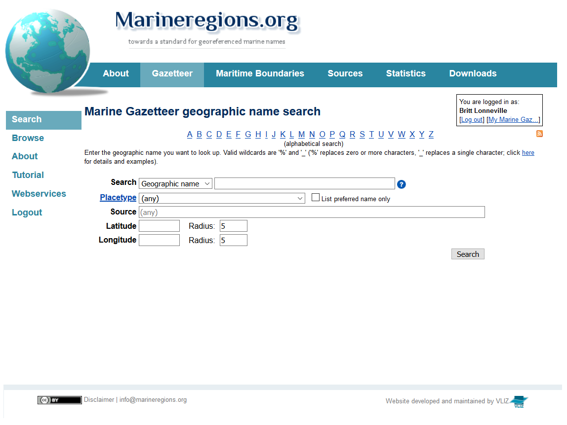
When searching for a name, please also take into account small spelling variations, synonyms or other languages.
Add a new GeoObject
The video below clearly explains the process of creating a new GeoObject for the MarineRegions gazetteer.
Before you add a new GeoObject, it is vital to check whether it is not yet available in the Marine Regions gazetteer. Since every GeoObject has a unique identifier, having the same feature twice in the gazetteer could create confusion and goes against the goal of the gazetteer.
You can search the Marine Regions gazetteer for a specific feature in several ways, but the two most straightforward ways are the gazetteer search page and hierarchical browser.
Because geographic place names can be spelled in different ways, it is important to verify this as well.
If the location is not present in the gazetteer, you can add it. Go to the Marine Regions gazetteer, login and go to My Marine Gazetteer.
- Click 'Add' under GeoObjects/Names
- Fill in all required fields, indicated by a *. It is highly recommended to provide coordinates for any new GeoObject.
- MRGID: a unique identifier, generated by the system
- Preferred name*: the name given to the GeoObject by the source
- Name source*: source of the GeoObject. You can look up all available MarineRegions sources by typing (part of) the name. If the source is not yet available, you can add it to the system. Please look into the section Add a new source first
- Placetype*: placetypes are subdivided into administrative and physical placetypes. Click here to see an overview of all placetypes and their description. If the placetype is not yet available, you can add it to the system. Please look into the section Add a new placetype first
- Language*: language of the name of the GeoObject
- Parent locality*: this will create the hierarchical tree of the localities by selecting an already existing GeoObject as parent for the new GeoObject. The main rule of thumb here is to always be as specific as possible
- Latitude/longitude: coordinates of the centroid of the GeoObject in decimal degrees (coordinate reference system: WGS 84). If possible, limit the number of decimals to five
- Minimum/maximum latitude/longitude: coordinates of the bounding box of the GeoObject in decimal degrees (coordinate reference system: WGS 84). If possible, limit the number of decimals to five

Add a new source
The video below clearly explains the process of creating a new source for the MarineRegions gazetteer.
There are four source types in Marine Regions: publications, databases, persons and institutes. The provided source is preferably a peer-reviewed publication, a published dataset or an authoritative gazetteer or vocabulary. In this way, we assure high quality entries for our users, and they can easily look up and verify the information for themselves.
You can look through the already available sources on the gazetteer search page by typing in part of the source name. If the specific source you had in mind is not available yet, please log in and go to My Marine Gazetteer to add the source to Marine Regions prior to adding your new GeoObject or placetype, or performing a specific edit.
Prior to adding your source, it is highly recommended to check whether it is already included in the Integrated Marine Information System (IMIS). If your source is already listed in IMIS, you can unambiguously refer to it by providing the IMIS ID. If it is not yet listed in IMIS, and you would like to see it added, please contact the Marine Regions data management team through info@marineregions.org. Having this IMIS ID will significantly increase the information value of your entry.
- Click 'Add' under Sources / Literature
- Fill in all required fields:
- Source name: proper citation of the database or publication, name of the person or institute
- Source type: publication, database, person or institute
- IMIS ID: this will refer users to the metadata page in IMIS. If the source is not listed in IMIS, you can request the Marine Regions data management team to add it to the database
- URL: provide a meaningful URL that will lead the user to more information about this specific source
Add a new placetype
The video below clearly explains the process of creating a new placetype for the MarineRegions gazetteer.
In Marine Regions, placetypes are subdivided into two categories. You can have physical placetypes such as seamounts, rivers and dunes, or administrative placetypes such as countries, Exclusive Economic Zones or FAO Fishing Areas. An overview of all placetypes that are available in the Marine Regions gazetteer can be found here. If the specific placetype you had in mind is not available yet, please log in and go to My Marine Gazetteer to add the placetype to Marine Regions prior to adding your new GeoObject.
- Click 'Add' under Placetype
- Fill in all required fields:
- Placetype name: name of the new placetype (preferably use a capital letter)
- Placetype category: physical or administrative placetype
- Source: the source of any new Marine Regions placetype is preferably a peer-reviewed publication, or an authoritative vocabulary or gazetteer. You can look through the already available sources in Marine Regions by typing in part of the source. If it is not available yet, return to the My Marine Gazetteer page and add the source to Marine Regions. Please look into the section Add a new source first
- Description: a description or definition for the new placetype
- Dutch appellation: if available, provide the placetype name in Dutch
- Dutch description: if available, provide the description in Dutch
Edit the information of a GeoObject
If needed, you can edit your entries, but also add synonyms, the name of the same GeoObject in another language, relations, notes, precision,....
- Edit/add place names
- Synonyms are useful as GeoObjects can have other names, in the same or another language, a small spelling difference,... These names can be linked with the GeoObject by adding new names. For instance, the Scheldt river is known as the Scheldt (English), Schelde (Dutch) or Escaut (French). Add a synonym or place name in another language by clicking [add]. Please note there can only be one preferred name, so if you tick this box when adding a new place name, it has to be unchecked for the other place names. In most cases, the preferred name is the English term of the place name, unless the source indicates otherwise.
- Edit an already existing place name by clicking [edit] next to the name you want to change. Spelling, language and source can be changed.
- Add precision
- The precision indicates the the horizontal distance (in meters) from the given latitude and longitude describing the smallest circle containing the whole of the GeoObject. You can leave this empty if the uncertainty is unknown, cannot be estimated, or is not applicable (because there are no coordinates). (Darwin Core term: coordinateUncertaintyInMeters)
- Add the precision of a GeoObject by clicking [edit] next to the Latitude or Longitude fields.
- Edit the parents/relation types
- If you have more information on the relation of a GeoObject with other GeoObjects, or a more precise parent in the hierarchy, please feel free to change the information in our system.
- Possible relations are:
- Part of: indicates a child-parent relation between two GeoObjects that (a) share any portion of space (geometrical intersection), or (b) have a child-parent relation on a conceptual level (e.g. the Belgian Exclusive Economic Zone is part of Belgium, even though there is no geometrical intersection),
- Partly part of: indicates a child-parent relation between two GeoObjects that share any portion of space (geometrical intersection). The child has this relation with at least one other parent,
- Administrative part of: indicates an administrative relation between a child and parent GeoObject where the two GeoObjects are not necessarily physically connected (e.g. overseas territories),
- Adjacent to: GeoObject lies next to this GeoObject,
- Rises in: indicates that a body of water has its source in another GeoObject,
- Flows through: to indicate the GeoObject the waterflow flows through.
- Flows into: the GeoObject where the mouth of a waterflow is situated,
- Influenced by: indicates that one feature influences another. For example, a drift is influenced by a water mass or current. This water mass or current determines the sedimentation, erosion and movements of these sediments,
- Has preferred alternative: indicates that unless there is a strong preference for this GeoObject, it is recommended to use the other GeoObject. The system will indicate the the GeoObject you refer to as the standard GeoObject,
- Is replaced by: this object is not correct (anymore) and should be replaced by the one indicated here.
Flag a GeoObject as 'checked'
Editors can flag a GeoObject as checked, if the quality of the GeoObject has been controlled.
- After quality control of the GeoObject, the GeoObject can be flagged as checked. This implies that the name(s), the sources, the geographic coordinates and the relations have been checked and are valid. The system will then indicate at the bottom of the page who checked the GeoObject.
- When a specific relation has been checked and is valid, this relation can also be flagged as checked.

Import
How to import a large amount of data?
If you have a large amount of data, you can use this excel-file to send info@marineregions.org the data, and we will import all data automatically into the MarineRegions gazetteer database.
- Mandatory information:
- Preferred name
- Language
- Source
- Placetype
- Parent
- Recommended information:
- Coordinate information (centroid/bounding box)
Overview of requested fields
| Field name | Necessity? | Description |
|---|---|---|
| Preferred name* | Mandatory | Name of the GeoObject, preferably in English |
| Language* | Mandatory | Language of the name, default language is English |
| Latitude | Recommended | Y coordinate of the centroid of the GeoObject in decimal degrees (coordinate reference system: WGS 84). If possible, limit the number of decimals to five |
| Longitude | Recommended | X coordinate of the centroid of the GeoObject in decimal degrees (coordinate reference system: WGS 84). If possible, limit the number of decimals to five |
| Precision | Where appropriate | The horizontal distance (in meters) from the given Latitude and Longitude describing the smallest circle containing the whole of the GeoObject. Empty if the uncertainty is unknown, cannot be estimated, or is not applicable (because there are no coordinates). (Darwin Core term: coordinateUncertaintyInMeters) |
| Minimum Latitude | Where appropriate | Minimum Y coordinate of the GeoObject in decimal degrees (coordinate reference system: WGS 84). If possible, limit the number of decimals to five. |
| Maximum Latitude | Where appropriate | Maximum Y coordinate of the GeoObject in decimal degrees (coordinate reference system: WGS 84). If possible, limit the number of decimals to five |
| Minimum Longitude | Where appropriate | Minimum X coordinate of the GeoObject in decimal degrees (coordinate reference system: WGS 84). If possible, limit the number of decimals to five |
| Maximum Longitude | Where appropriate | Maximum X coordinate of the GeoObject in decimal degrees (coordinate reference system: WGS 84). If possible, limit the number of decimals to five |
| Source* | Mandatory | Source for the GeoObject. The source can be a database, publication, person or institute |
| Placetype* | Mandatory | Subdivided into administrative and physical placetypes. An overview of placetypes and their description can be found on the 'Placetypes'-sheet. If the PlaceType you are looking for is not included here, please double check with this list to see if it has not been added in the meantime, and request the PlacetypeID from the MarineRegions team (info@marineregions.org) |
| Relation 1* | Mandatory | This will create the hierarchical tree of the localities by selecting an already existing GeoObject as parent for the new GeoObject. The main rule of thumb here is to always be as specific as possible |
| Parent 1* | Mandatory | This will create the hierarchical tree of the localities by selecting an already existing GeoObject as parent for the new GeoObject. The main rule of thumb here is to always be as specific as possible |
| Alternative name 1 | Where appropriate | Synonym, spelling variation, other language, … |
| Language 1 | Where appropriate | cfr. Language |
| Alternative name 2 | Where appropriate | cfr. Alternative Name 1 |
| Language 2 | Where appropriate | cfr. Language |
| Alternative name 3 | Where appropriate | cfr. Alternative Name 1 |
| Language 3 | Where appropriate | cfr. Language |
| Relation 2 | Where appropriate | cfr. Relation 1 |
| Parent 2 | Where appropriate | cfr. Parent 1 |
| Relation 3 | Where appropriate | cfr. Relation 1 |
| Parent 3 | Where appropriate | cfr. Parent 1 |
| Additional information/note | Where appropriate | Remarks, useful information, … |

