| MRGID |
http://marineregions.org/mrgid/11781 |
| Status |
Proposed standard  |
| Names |
| Language |
Name |
Name source |
| English | Lemaire Island | SCAR Composite Gazetteer |
| French | Ile Lemaire | SCAR Composite Gazetteer |
| Dutch | Eiland Lemaire | Beeckman, N. (1988). Belgica: de eerste overwintering in Antarctica 1897-1899 = Belgica: le premier hivernage premier hivernage dans l'Antarctique 1897-1899. North Sea Society: Antwerpen. 77 pp. (look up in IMIS) |
| Spanish | Lemaire, Isla | SCAR Composite Gazetteer |
| Spanish | Le Maire, isla | SCAR Composite Gazetteer |
|
| PlaceType |
Island |
|
|
| Latitude |
64° 49' 0" S (-64.8166667°) |
| Longitude |
62° 57' 0" W (-62.95°) |
|
|
| Source |
SCAR Composite Gazetteer, available online at https://data.aad.gov.au/aadc/gaz/scar/ |
|
|
| Image |
|
| Notes |
Belgica information (nl): C. Lemaire verkende Kongo |
|
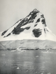
Belgica information (en): Island 4.5 mi long and 1.5 mi wide, lying 1 mi W of Duthiers Point off the W coast of Graham Land. Discovered by the BelgAE, 1897-99, under Gerlache, who named it for Charles Lemaire (http://www.mapplanet.com/?do=loc&country=_A&adm1=08&loc=20007061 / http://geonames.usgs.gov). |
|
|
| Relation |
|
| Map |
|
|
|
|
|
|
|
| Edit history |
Last edited on 2006-04-06 14:59:04 by Deckers Pieter
|
|
|
|
|
|
[Google] [Google scholar] [Google images] |


