| MRGID |
http://marineregions.org/mrgid/14834 |
| Status |
Proposed standard  |
| Name |
| Language |
Name |
Name source |
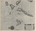
| English | Hebrides | Getty thesaurus of geographic names |
|
| PlaceType |
Archipelago |
|
|
| Latitude |
56° 59' 36.2" N (56.9934°) |
| Longitude |
6° 56' 29.4" W (-6.9415°) |
|
|
| Precision |
200000 meter |
|
|
| Min. Lat |
55° 37' 12" N (55.62°) |
| Min. Long |
5° 30' 0" W (-5.5°) |
|
|
| Max. Lat |
58° 57' 36" N (58.96°) |
| Max. Long |
8° 45' 0" W (-8.75°) |
|
|
| Source |
Getty thesaurus of geographic names, available online at http://www.getty.edu/research/tools/vocabularies/tgn |
|
|
| Image |
|
| Relations |
|
| Map |
|
|
|
|
|
|
|
| Edit history |
Last edited on 2014-08-19 09:07:05 by Vancraeynest Freek
|
|
|
|
|
|
[Google] [Google scholar] [Google images] |


