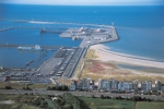
| MRGID |
http://marineregions.org/mrgid/19674 |
| Status |
Proposed standard  |
| Names |
| Language |
Name |
Name source |
| Dutch | Baai van Heist | Kolokythas, G.; Fonias, S.; Wang, L.; De Maerschalck, B.; Vanlede, J. (2023). Modelling Belgian Coastal zone and Scheldt mouth area: Sub report 14. Scaldis-Coast model – Model setup and validation of the morphodynamic model. Version 4.0. FH reports, 15_068_14. Flanders Hydraulics: Antwerp. VIII, 217 + 17 p. app. pp. https://dx.doi.org/10.48607/214 (look up in IMIS) |
| English | Bay of Heist | Kolokythas, G.; Fonias, S.; Wang, L.; De Maerschalck, B.; Vanlede, J. (2023). Modelling Belgian Coastal zone and Scheldt mouth area: Sub report 14. Scaldis-Coast model – Model setup and validation of the morphodynamic model. Version 4.0. FH reports, 15_068_14. Flanders Hydraulics: Antwerp. VIII, 217 + 17 p. app. pp. https://dx.doi.org/10.48607/214 (look up in IMIS) |
|
| PlaceType |
Natural Reserve |
|
|
| Latitude |
51° 21' 0" N (51.35°) |
| Longitude |
3° 14' 24" E (3.24°) |
|
|
| Source |
Kolokythas, G.; Fonias, S.; Wang, L.; De Maerschalck, B.; Vanlede, J. (2023). Modelling Belgian Coastal zone and Scheldt mouth area: Sub report 14. Scaldis-Coast model – Model setup and validation of the morphodynamic model. Version 4.0. FH reports, 15_068_14. Flanders Hydraulics: Antwerp. VIII, 217 + 17 p. app. pp. https://dx.doi.org/10.48607/214 (look up in IMIS) |
|
|
| Image |
|
| Relation |
|
| Map |
|
|
|
|
|
|
|
| Edit history |
Last edited on 2024-08-06 08:51:16 by Whatley Lawrence
|
|
|
|
|
|
[Google] [Google scholar] [Google images] |


