| MRGID |
http://marineregions.org/mrgid/24493 |
| Status |
Alternative classification  |
| Name |
| Language |
Name |
Name source |
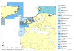
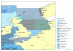
| English | (Historical) fishing areas of Belgian sea fisheries | Belgian Sea Fisheries |
|
| PlaceType |
Historical fishing areas |
|
|
| Latitude |
65° 45' 55.5" N (65.76541°) |
| Longitude |
0° 11' 1.6" E (0.18379°) |
|
|
| Min. Lat |
26° 0' 33.7" N (26.0094°) |
| Min. Long |
64° 15' 16.3" W (-64.2545°) |
|
|
| Max. Lat |
90° 0' 0" N (90°) |
| Max. Long |
68° 16' 4.1" E (68.2678°) |
|
|
| Source |
Belgian Sea Fisheries, available online at http://www.vliz.be/EN/Figures_Policy/Belgian_Sea_Fisheries |
|
|
| Images |
|
| Relation |
|
| Map |
|
|
|
| Shapefile |
[download] or view the complete Historical fishing areas shapefile |
|
|
|
|
| Edit history |
Last edited on 2024-05-21 09:23:57 by Lonneville Britt
|
|
|
|
|
|
[Google] [Google scholar] [Google images] |


