Marine Gazetteer Placedetails
| MRGID | http://marineregions.org/mrgid/14525 | |||||||||
| Status | Proposed standard |
|||||||||
| Names |
|
|||||||||
| PlaceType | Knoll(s) | |||||||||
| Latitude | 62° 43' 27" S (-62.72416667°) | |||||||||
| Longitude | 60° 11' 53" W (-60.19805556°) | |||||||||
| Source | Bulgarian Antarctic Gazetteer, available online at https://apcbg.org/ | |||||||||
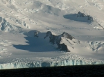
| Image | ||||||||||
| Links | http://apc.mfa.government.bg/peaks/radomir.htm (Info page on Bulgarian Gazetteer website) | |||||||||
| http://apc.mfa.government.bg/site/images/sm_peaks/Radomir-Location.JPG (Location photo) | ||||||||||
| http://apc.mfa.government.bg/site/images/sm_peaks/Radomir.jpg (Landscape photo) | ||||||||||
| Relation |
|
|||||||||
| Map | ||||||||||
| Edit history | Last edited on 2005-01-01 00:00:00 by db_admin | |||||||||
| [Google] [Google scholar] [Google images] |


