Marine Gazetteer Placedetails
| MRGID | http://marineregions.org/mrgid/2357 | ||||||
| Status | Proposed standard |
||||||
| Name |
|
||||||
| PlaceType | IHO Sea Area | ||||||
| Latitude | 53° 26' 45.4" N (53.44594722°) | ||||||
| Longitude | 4° 47' 53.4" W (-4.79817511°) | ||||||
| Precision | 212098 meter | ||||||
| Min. Lat | 51° 54' 14.9" N (51.9041°) | ||||||
| Min. Long | 6° 34' 8.6" W (-6.5691°) | ||||||
| Max. Lat | 55° 0' 15" N (55.0042°) | ||||||
| Max. Long | 2° 38' 21" W (-2.6392°) | ||||||
| Source | (1953). Limits of oceans and seas. 3rd edition. IHO Special Publication, 23. International Hydrographic Organization (IHO): Monaco. 38 pp. (look up in IMIS) | ||||||
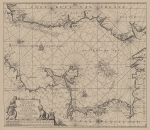
| Image | |||||||
| Relation |
|
||||||
| Map | |||||||
| Download |
Layer: MarineRegions:iho - format: |
||||||
| Shapefile | [download] or view the complete IHO Sea Area shapefile | ||||||
| Edit history | Last edited on 2017-01-18 17:22:03 by De Hauwere Nathalie | ||||||
| [Google] [Google scholar] [Google images] |


