Maps
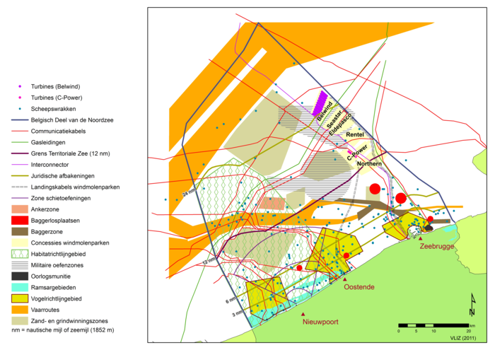
The use of the Belgian Continental Shelf.
Description The main activities include maritime transport and port activities, dredging, fishing, sand extraction, cables, pipelines, offshore wind farms, nature and a military training area.(Zeewetenschappen).
PNG file - 5.89 MB - 7 012 x 4 962 pixels
added on 2012-11-284 651 viewsGazetteer Places on this image:Belgian Exclusive Economic Zone
From reference Copejans, E.; Smits, M. (2011). De wetenschap van de zee:...
Download full size
This work is licensed under a Creative Commons Attribution-NonCommercial-ShareAlike 4.0 International License
Click here to return to the thumbnails overview


